Updated: August 24, 2026. For real-time details, rely on official announcements.
Taiwan is excellent for hiking, but it is not only Xiangshan and Alishan. From small city hills to high-mountain traverses, the difference is not just elevation. Weather, permits, escape routes, and whether you can get down before dark all matter.
When planning a first hike in Taiwan, photos can easily take over. Cloud seas, ridgelines, railways, and forests all end up on the same list. Once you arrive, though, some trails take only half a day, some require hut or campsite applications, and some should not be forced during afternoon thunderstorms. Taiwan's advantage is choice, and its challenge is also choice: first decide whether you are taking a walk, going hiking, or entering real mountain terrain.
For a first Taiwan hiking plan, I would keep the schedule conservative. Short trails near cities are good for getting used to humidity, stairs, and signs. Forest recreation areas make you think about transport, tickets, and weather together. National park and high-mountain routes require checks on park entry, mountain permits, huts, trail conditions, and group ability. If you are still planning the whole trip, start withthe complete first-time Taiwan travel guideandthe Taiwan Travel Guides category; for season timing, pair it withthe best time to visit TaiwanwithTaiwan typhoon season travel notes.
Do Not Put City Hills, Forest Trails, and High Mountains in One Difficulty Level
The Tourism Administration has a hiking trails section. Taiwan Forest Recreation, run by the Forestry and Nature Conservation Agency, lists forest recreation areas, natural trails, and related services. Hike Smart Taiwan focuses on national park huts, campsites, park entry, and mountain information. Together, these sources point to the same lesson: Taiwan trails are managed by different agencies and carry different risk levels, so distance alone does not tell you whether a route is difficult.
| Route type | Good fit | Check first |
|---|---|---|
| City hills | A half-day or evening walk, useful for getting used to Taiwan's stairs, humidity, and trail signs. | Stone steps can be slippery after rain, so check sunset time and return transport first. |
| Forest recreation areas and natural trails | A day trip that can combine forest scenery, railways, cooler air, and easier trails. | Opening hours, tickets, shuttles, bus schedules, and weather can all affect the trip. |
| National park mid-level mountains | Experienced hikers may plan a longer day or an overnight trip, but this is not for last-minute decisions. | Park entry applications, trail notices, group ability, rain gear, and turnaround points all need checking. |
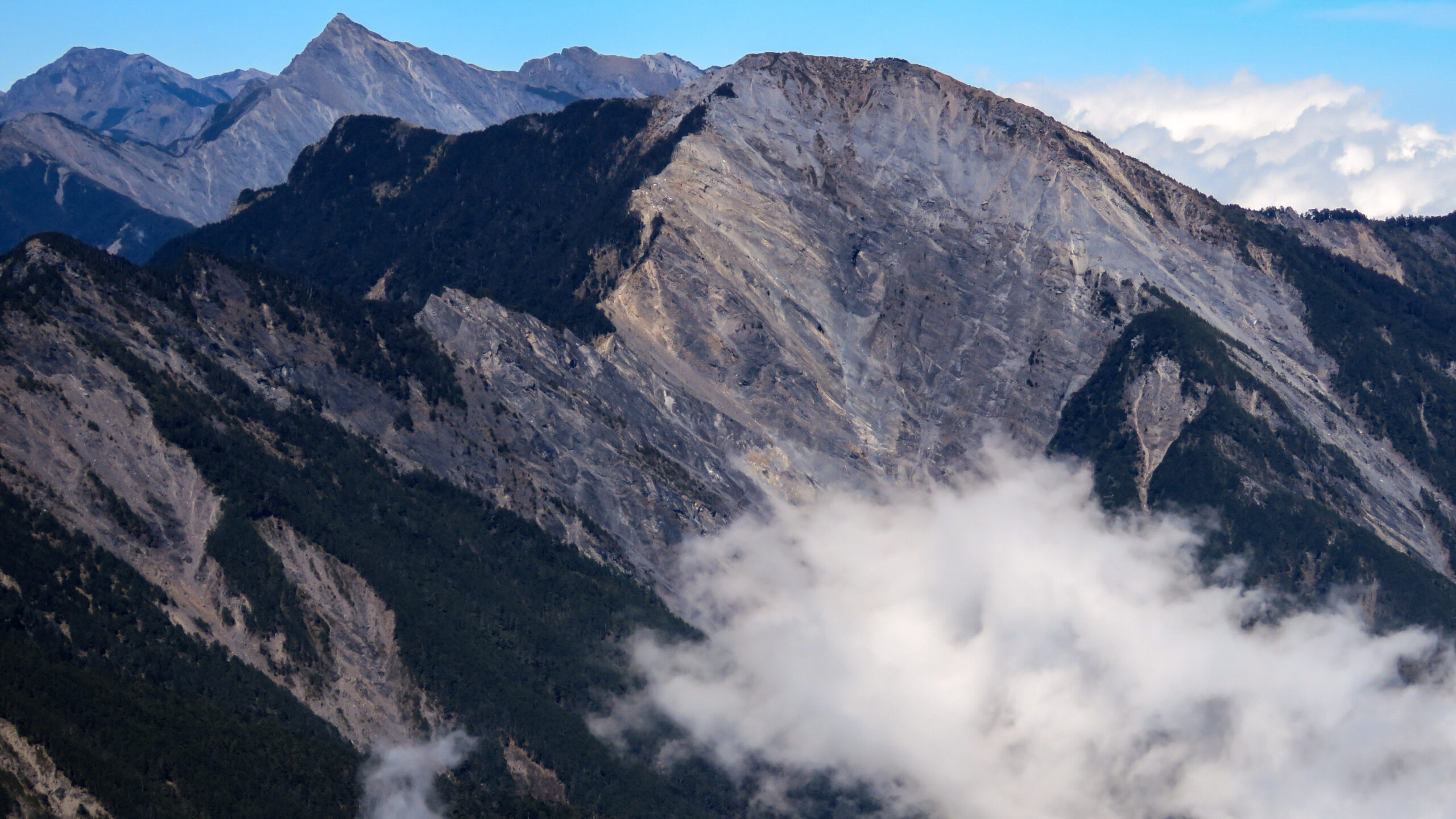
| High mountains and Baiyue peaks | Best for people with training, proper gear, and high-altitude experience. | Huts or campsites, permits, warmth, a headlamp, offline maps, and insurance should not be skipped. |
If you simply want mountain scenery in the trip, you do not have to challenge a high mountain right away. In Taipei, start with easier-to-reach trails around Xiangshan or Yangmingshan. In central Taiwan, Alishan and Sun Moon Lake trails can fit into one or two days. Around Hualien and Taroko, pay close attention to roads, trail openings, and rockfall risk. Anyone who has readthe Taroko Gorge guidewill already know that dramatic terrain usually means official notices matter more.
Gear Is Not About Buying More. It Is About Knowing When to Turn Back
Mountain weather in Taiwan changes quickly, and elevation differences are large. Low elevations can be humid and sweaty, while higher areas can suddenly turn foggy, cold, or rainy. Starting from a city on the same day can still lead to very different conditions. Recheck Central Weather Administration forecasts, national park notices, and trail management updates before departure. If information changes, switching to a cafe or city walk is not a failure. It preserves the trip.
For basic gear, keep it simple but do not skip essentials: grippy shoes, enough water, rain gear, a light jacket, a power bank, offline maps, a headlamp, simple food, and a trash bag. For high mountains or longer routes, add warmth, first aid, location tools, insurance, and hut or campsite applications to the plan. Do not treat mobile signal as your only safety tool. Many parts of Taiwan's mountains have unreliable reception, and the group should not spread out too far.
Route choice should also fit the rhythm of the trip. If you already plan to usethe Alishan guide, forest trails will usually fit better than forcing in a distant high mountain. If you are buildingthe 7-day Taiwan itinerary, place the hiking day in the lower-pressure middle of the trip, not the day before an international flight. Coastal, mountain, and typhoon-season risks also affect each other. After readingthe Taiwan beaches and islands guide, use the same logic: when the weather is unstable, keep a backup plan.
The most useful rule is simple: on your first Taiwan trip, choose a trail with easy transport, clear bailout options, and official information that is easy to check. Once you are used to the humidity, stairs, signs, and resupply style, put longer, higher, and more remote routes into a later trip. Taiwan's mountains will still be here. You do not need one trip to prove anything.
Sources checked: Tourism Administration hiking trail information, Taiwan Forest Recreation from the Forestry and Nature Conservation Agency, Hike Smart Taiwan Service, and national park hiking safety information. Trail openings, park and mountain permits, huts and campsites, weather, and road conditions should still be checked against official announcements.
Leave a Reply