Updated: 2026-10-13 | Check official notices for information that may change.
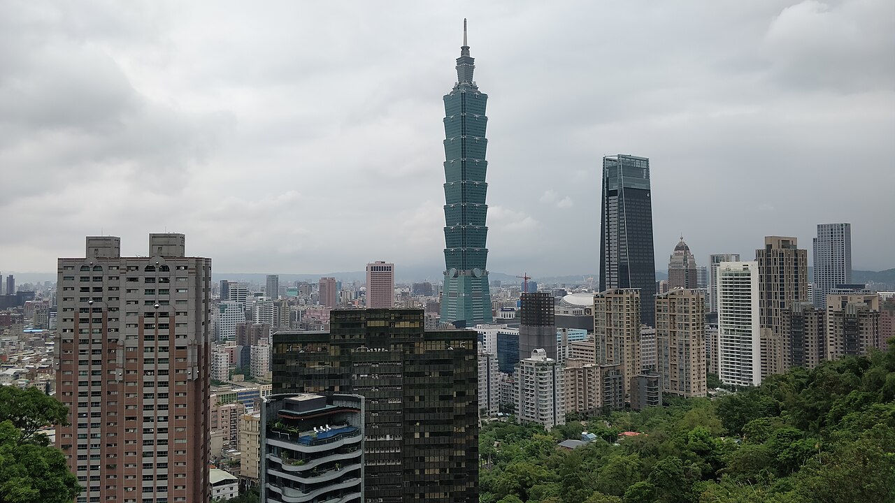
For a half-day view of Taipei 101 from Xiangshan, finding the right trailhead, choosing a climb that suits you, and leaving time to descend matter more than reaching the Six Giant Rocks quickly.
Xiangshan Hiking Trail is close to Taipei’s Xinyi District, but it still involves stone steps and changing weather. On a first visit, choose one viewpoint where you can stop safely instead of trying to complete every platform and rock. Start at Xiangshan MRT Station and follow local signs to the Lingyun Temple trailhead. After enjoying the view, return by the same route or a clearly marked alternative. If you have several days in Taipei, use our Taipei travel guide to place Xiangshan on a half-day with stable weather. Our Taipei day-trip ideas let you compare places that require more travel time.
From Xiangshan MRT Station to Lingyun Temple: the uphill routes differ
Taipei Metro’s Xiangshan Station page places Exit 2 at Lane 150, Section 5, Xinyi Road, near Xiangshan Park. The Taipei Geotechnical Engineering Office trail guide also identifies Xiangshan as a trail accessible from the MRT. You still have to walk through city streets to reach the trailhead; the climb does not start at the station exit. Follow station and street signs. The office’s figure of about 1.45 km describes the whole Xiangshan trail, not the one-way distance to the Six Giant Rocks or the route every half-day visitor must take. Do not combine estimates with different starting points as if they were a guaranteed time.
The city’s route description shows a climb from the Lingyun Temple trailhead and steps toward the Six Giant Rocks at a junction. Other marked branches include Yixiantian, the narrow rock passage; some climbs are steep. A mountain path is not level or step-free. Anyone with knee problems, a stroller or limited mobility should consider a flat alternative. Give way on the ascent, hold the rail where available, and avoid stopping for photos on narrow stairs. Read the map at each junction rather than following crowds onto a steeper route. If you prefer a level walk, compare our Dadaocheng walk; the two routes require different levels of effort.
| Half-day decision | Suggested approach | Check on site |
|---|---|---|
| City view only | Choose one open viewpoint as your turnaround point | Visibility, crowds and time to descend |
| Six Giant Rocks | At the junction, choose a suitable climb and turn back after the view | Steps, energy and weather |
| Longer walk | Read the official route map and carry enough water and time | Exit location, trail conditions and sunset |
| Rain or fatigue | Shorten or cancel the climb and choose a city activity | Official notices and current weather |
Six Giant Rocks is a viewpoint, not a reason to scramble; plan the descent before sunset
The Six Giant Rocks and photo platform are popular, but that is no reason to climb high onto a rock or cross a barrier for a picture. Wet stone, roots, leaves and crowds can make the ground slippery; a photograph is not worth a fall. The Geotechnical Engineering Office viewpoint guide lists platforms and the Six Giant Rocks, and asks visitors not to occupy public railings with tripods. Keep the route clear at an open platform, watch for steps and other hikers behind you, and do not block the trail while waiting for an empty frame. Clouds or poor visibility may obscure Taipei 101, but a short walk and city panorama can still be worthwhile.
For sunset, check its time and trail conditions before leaving, then plan to start down early. Stone steps and wet ground are harder after dark. Carry water, wear grippy shoes and charge your phone. Do not continue in thunderstorms, strong wind or when the city announces a closure. Our Taiwan rainy-day itinerary guide can replace the outdoor leg with an easy-to-reach indoor activity. If transferring after the descent, our EasyCard guide can help with MRT payment; check station information for the last train and transfers on your travel day. A comfortable Xiangshan half-day includes MRT travel, the street walk, the climb, the view and the descent—not just the minutes to the rocks. If conditions or energy change, turn back from a safe open platform.
Leave a Reply